Home /

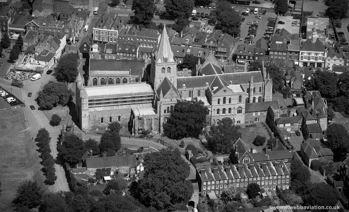
Rochester Cathedral from the air

Rochester_Cathedral_aa06288bw.jpg Rochester Cathedral from the airThumbnailsLimehouse Wharf on the Rochester Riverside Development, from the airRochester Cathedral from the airThumbnailsLimehouse Wharf on the Rochester Riverside Development, from the airRochester Cathedral from the airThumbnailsLimehouse Wharf on the Rochester Riverside Development, from the airRochester Cathedral from the airThumbnailsLimehouse Wharf on the Rochester Riverside Development, from the airRochester Cathedral from the airThumbnailsLimehouse Wharf on the Rochester Riverside Development, from the airRochester Cathedral from the airThumbnailsLimehouse Wharf on the Rochester Riverside Development, from the airRochester Cathedral from the airThumbnailsLimehouse Wharf on the Rochester Riverside Development, from the air
Buy this picture

aerial photograph of Rochester Cathedral, Rochester Kent UK. Rochester Cathedral is a Norman Church built to replace an earlier Saxon church, at the end of the 11th and beginning of the 12th centuries. Construction started in 1080 and took around 5o years. The church was looted during the second Barons War and at one point Knights on horseback actually rode into the Cathedral to take captives. In 1535 the Bishop of Rochester was beheaded by Henry VIII due to his opposition to the English Reformation. It was at Rochester Cathedral where , in 1540, Henry VIII met met Ann of Cleves and was apparently Greatly disappointed. After the Priory assets were confiscated during the dissolution of the monasteries, the building fell into a period of decline but continued to be used and was visited by Queen Elizabeth I in 1573. By the 17th century the building had been much repaired but was then damaged by Parliamentarian troops under Thomas Fairfax, during the English civil war. At one point Fairfax even stabled horses within the Cathedral. During the 19th century the building was much restored by George Gilbert Scott.

Albums
Visits
3027
Prints are available from just £50 and usage licences from just £195 - see my price list left and the shopping cart below the photo. The easiest way to navigate this gallery is using the geographic menu on the left. The aerial photographs are all organised in galleries according to their location so start with the county and then choose the town or village. Wales & Scotland are at the bottom under the English Counties. If your looking at a picture and are not sure where it is, click the arrow on the upper right and it will show you which album it is in. Click the album name to see nearby images. There is a search facility ( bottom left ) but this only works with words I have put into it. That's fine for searches of places or well known buildings but in most cases I have not entered road name or a post code. The gallery is only a small part of my collection of UK aerial photographs so please Email if you would like to buy an aerial view of something not shown in the gallery. There are over 25,000 photos in the gallery and I have an archive of around half a million pictures going back to 1999. Although these images are usually referred to as drone photos they are actally taken with aeroplanes and helicopters which is why I can take them from much higher up than drone photographers are allowed to fly. The shopping cart is just a few of the popular items, there are more options starting at just £50 on my prices page. With prints and wall products I can produce any size or style that the photo lab produces, just email for a quote. NB the shopping cart are for standard sizes, many pictures in my gallery are non standard such as panoramic or square. In these cases either the prints need to be made non standard or the image made to fit the print size. Obviously purchase of a print or wall product does not grant rights to make copies for which you also need to buy a licence Prints and Wall Products are made specially to order and therefore cannot be cancelled or refunded so please choose carefully.